About FutureWater

The results we display in maps and graphs represent our application and adaptation of well-accepted scientific data and models. Future water science and all science at its best is subject to continual testing, questioning, improvement and revision. The data and models available in years to come, and the assumptions underlying them, may produce results that differ in significant ways from those we can provide today.

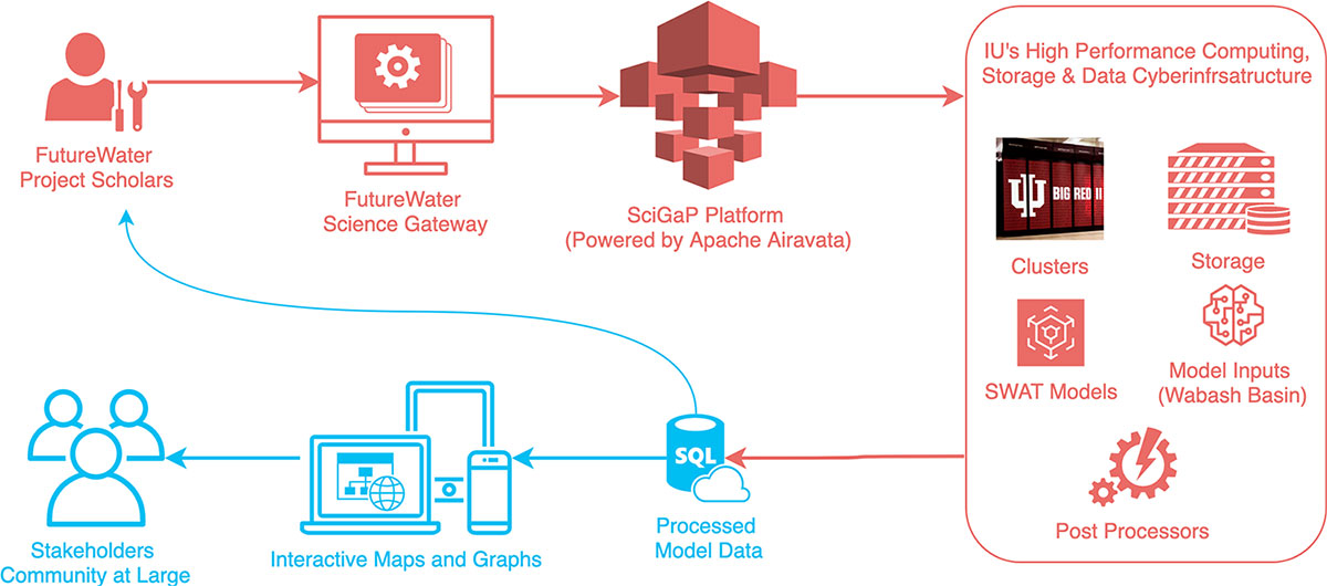
The models on this community platform are products of collective efforts by a large group of post-doctoral, graduate, and undergraduate students, UITS staff, and faculty members. The platform is also intended for teaching the impact of climate change.

Computer models of watersheds can help us understand the relationship between climate, water quantity, and water quality.

We build models

To help us understand how Indiana’s hydrology will change in response to changes in our climate, we built a computer model of the Wabash River watershed – a regional watershed covering most of the State of Indiana. This computer model was constructed using the Soil and Water Assessment Tool (SWAT) – a watershed modeling program developed by the Agricultural Research Service (ARS) of the U.S. Department of Agriculture (USDA). Our computer simulations predicted the water cycles to the year 2100 under two IPCC CO2 emission scenarios: RCP 4.5 and 8.5, representing a medium- and high-emissions scenario, respectively. In our judgment, SWAT and the RCP scenarios represent an appropriate foundation for our predictive models, but of course other assessment tools and other scenarios exist. You can find a brief introduction from the RESEARCH tab and find interactive maps on the community platform.

Connect to the platform

Figure 1. Wabash Basin.

The Community Platform